
If you’re looking for an excuse to get off the pavement while on your way from the Rockies to the Okanagan, this British Columbia backcountry road is a few kilometres shorter than the regular route via Sicamous. But like most backroad shortcuts, the Mabel Lake Shortcut will probably take you twice as long as Highway 1 and Highway 97A.
Advertisement
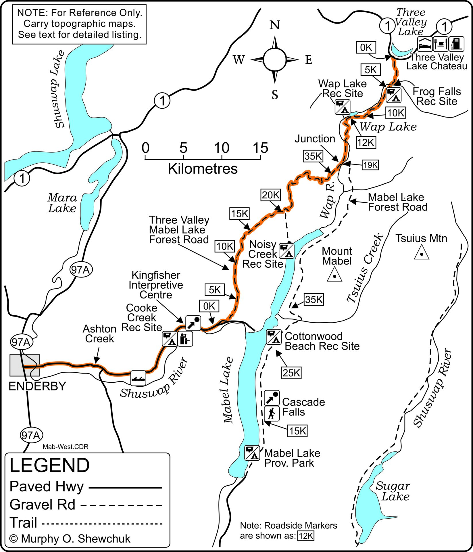
There are, however, two major reasons to make a mid-summer meander through the heart of the Monashee Mountains. The first is to get away from the hell-bent-for-destruction crowds that seem intent on turning the Trans-Canada Highway into a training ground for crash-test dummies. The second reason is actually much more positive than negative, unless you happen to be a fish: the route provides relatively easy access to quiet recreation sites on Wap Lake, Mabel Lake and several other off-the-road lakes.
Advertisement
 Wap Lake.
And please take note that this is a mid-summer excursion. The north end of this route passes through the heart of the Monashee rainforest and ease of access depends on logging activity and the prerequisite road maintenance. Washouts and late-season snowdrifts are common on the section between Three Valley Lake and Wap Lake, so a full fuel tank, a shovel and lots of time are definite requirements before heading south. These items, plus a chainsaw or a good swede saw and an axe should be part of any backroad explorer’s kit anyway.
Once Considered For A Major Highway
The Mabel Lake Shortcut hasn’t gone unnoticed. There were rumours nearly half a century ago that the government was considering routing a brand-new four-lane highway through here in a direct link from Revelstoke to the Okanagan Valley and then to the coast via the Okanagan/Coquihalla Connector. The arguments then – and now – are that this route, if continued down the west side of Okanagan Lake, would bypass most of the congestion and development of the Shuswap, Okanagan and Thompson Valleys. I have no idea if this route is still being considered and I don’t intend to ask anyone. It’s much more fun to speculate based on true ignorance than on inside knowledge.
Advertisement
We’ve made the Mabel Lake Shortcut several times during the past 40 years. The first was in mid-August 1986, and washouts and questionable bridges were common. By August 1988, a rotting bridge across the Wap River had been replaced by a steel structure and most of the washouts had been rerouted or rebuilt with larger culverts. By late October 2018, the road, though narrow and rough in spots, was easily passable by cars or light trucks with fair clearance. Logging was active in the area and logging trucks could be expected at any time. Although logging activity changes from year to year, it is probably safest to travel this route on weekends or evenings.
A Logging Railway
For the purpose of this backroad trip, kilometre 0 is the junction of the Trans-Canada Highway and Three Valley-Mabel Lake Forest Service Road, 20 kilometres west of Revelstoke near the west end of Three Valley Lake. The grade is easy here, with smooth, wide corners hinting that this is not your average logging road.
A bridge at kilometre 1.3 that looks remarkably like a railway bridge confirms the suspicion that other methods of transportation may have been used here before the rubber-tired vehicle became king of the backroad.
The late David Stewart, himself a king of the backroads, had a plausible explanation in Okanagan Backroads Volume 2, published by Saltaire in 1975 and long out of print. “The valley of the Wap has an interesting past,” wrote Stewart. “Around the turn of the century, an English firm with headquarters in London built a logging railroad from Three Valley, on the CP mainline, in past Wap Lake. Until two or three decades ago, traces of the old railway could be seen, along with a steam donkey engine and the big, old stumps left by the loggers of that far-away time. In 1948, I stumbled on several racks of steel rails not far west of Wap Lake (we called it Frog Lake in those days). Presumably this steel is still hidden in the dense underbrush: the logging railway it had been intended to extend having disappeared over the intervening four decades.”
The late Gordon Bell, then owner of the Three Valley Lake Chateau at the east end of Three Valley Lake, had the good fortune of meeting one of the descendants of the original operators. According to his information, the logging railway once extended as far south as Mabel Lake, with spur lines up many of the side valleys. The company operated one of the largest sawmills in western Canada at the west end of Three Valley Lake with, says Gordon, three planer mills, a post office and the Bell House hotel (no relation). The hotel was later dismantled and moved to the top of Mount Revelstoke where it became the Mount Revelstoke Chalet until Parks Canada tore it down around 1970. Note: Gordon Bell passed away in November 2007.
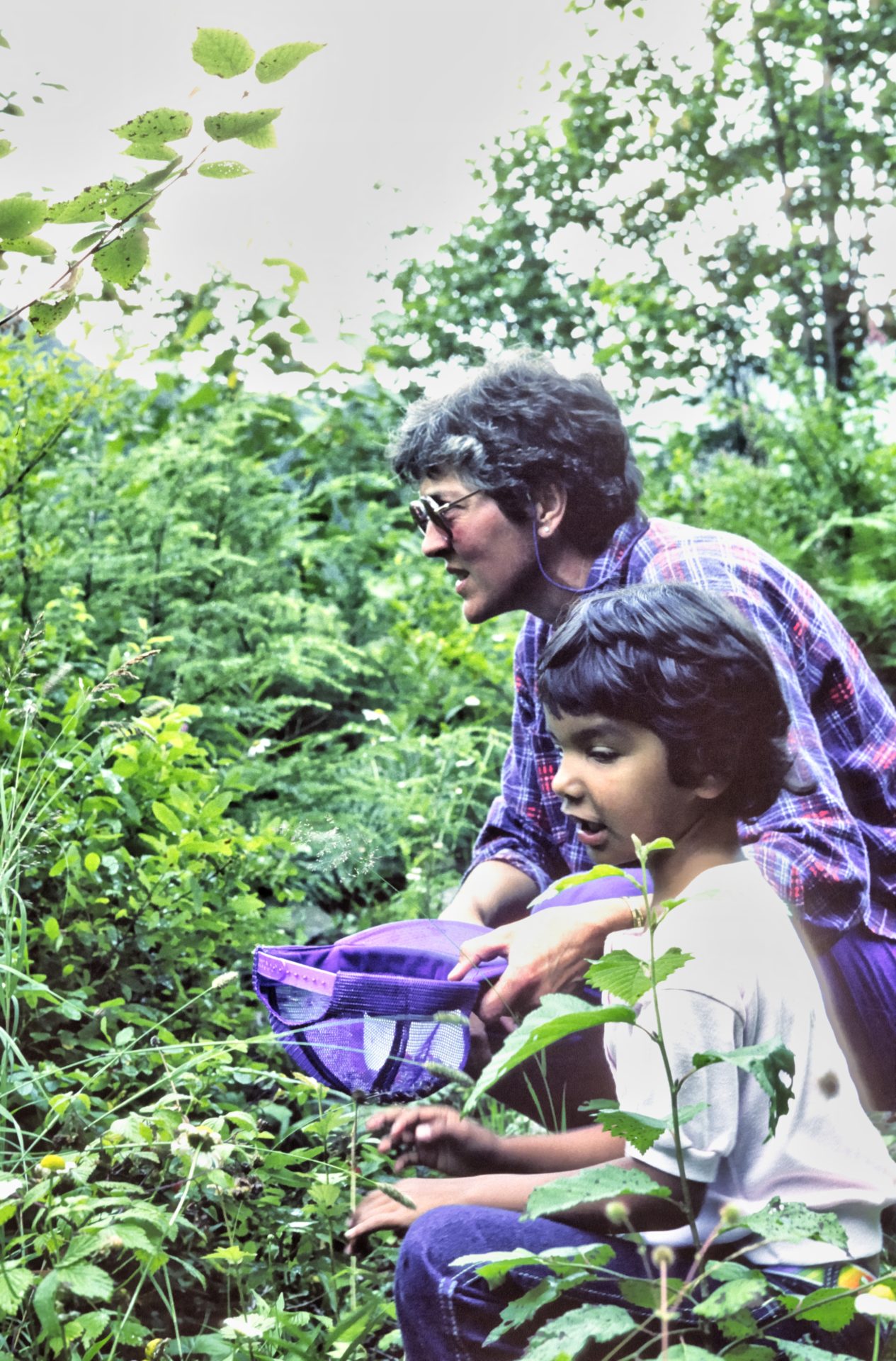 Picking Huckleberries at Wap Lake.
Giant Cedars
Giant cedar stumps, some still with clearly visible spring-board notches from the hand logging of a previous era, surround the Frog Falls Recreation Site at kilometre 4.4. Nearby Wap River starts in the southeast on the slopes of Mount Begbie, and after a northward rush, swings south here as it twists and tumbles down to Mabel Lake. A wide trail leads from the recreation site to the crest of the 25-metre-high, two-step Frog Falls.
The trail to the falls passes, buried in the mountainside, what was until recently one of the largest private hydroelectric plants in BC. Faced with an estimated $450,000 tab from BC Hydro to run lines from Revelstoke or Malakwa to his resort at Three Valley Gap, the late Gordon Bell set out to build his own power plant using the 30-metre head developed at Frog Falls and two additional, run-of- the-river dams farther upstream. After obtaining the necessary permits from seven different bureaucracies, Bell went ahead with construction.
The Three Valley Gap system is unusual in two ways. First, it uses water pumps operating as turbines to drive the 150,000-watt electric generator, instead of more expensive, specially designed turbines. Second, it is a constant load system, using an electronically controlled load distribution system to maintain a steady AC supply while heating and lighting the complete resort. Bell’s system cost almost what Hydro would have charged, but his real savings is the elimination of an enormous monthly energy bill.
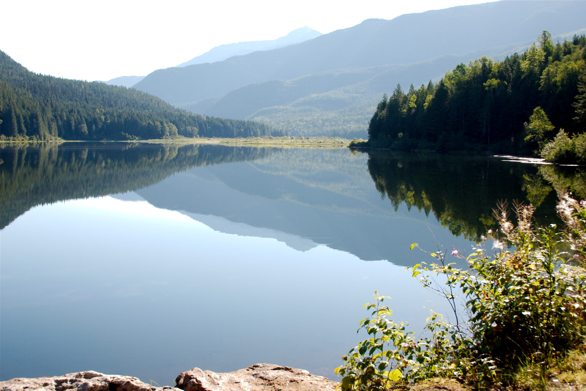
Wap Lake Recreation Site
The road south of the recreation site and the Wap River Bridge follow the old rail bed near the valley floor. Several side roads lead to the left into the high country and some maps hint that there may be a route to Sugar Lake through here, but I haven’t yet confirmed it. Water lily marshes near kilometre 10.5 are the first hints of Wap Lake, but it is almost two kilometres farther along the old rail bed before you reach the small recreation site at the west end of the lake.
South of the lake, the road swings away from the river for several kilometres. It skirts a knoll before crossing under a 500,000-volt power line near kilometre 16 and again crossing the river half a kilometre farther along. The BC Hydro power line links the Revelstoke hydro plant with the rest of the system at the Ashton Creek substation near Enderby.
A junction near kilometre 19 marks the beginning of a climb away from the valley floor. On one trip through, a small sign on the road to the right signalled the start of the Kingfisher Forest Service Road. On our latest trip, this road appeared to be a continuation of the Three Valley-Mabel Lake Forest Service Road. The road to the right leads to Enderby, while the road to the left (Mabel Lake Forest Service Road) again crosses Wap River, and with a little luck and good planning, could take you all the way to Lumby.
Noisy Creek Recreation Site
Three Valley-Mabel Lake Road climbs steadily, reaching an elevation of about 850 metres before it crosses into the Noisy Creek drainage. Side roads lead into several old log cuts (and a few newer ones) where wild blueberries, raspberries and huckleberries are plentiful. The roadside markers begin a countdown as you continue south. Another junction just south of the 21-kilometre marker (36 kilometres from Three Valley Lake) marks the route down to Noisy Creek Recreation Site at Mabel Lake. It’s a five-kilometre drive down to the lake, but the large recreation site and excellent beach are well worth the trip. In fact, the site is actually two quite different campgrounds, split by Noisy Creek and its delta. The south campground looks down the lake, with a few waterfront campsites and a larger number sheltered in the trees. The campground north of the delta gets the morning sun and could be better protected in case of storm. Although the road is somewhat rough, it is usually passable by truck campers and a variety of other vehicles. According to some of the campers we talked to, this has been a popular site for at least 30 years. Firewood is usually in short supply, so plan on bringing wood with you, or collecting it off the ground from the old logged areas on your way down.
Note that Noisy Creek is a Managed Recreation Site under the recently introduced recreation site program; daily fees are charged from May 1 to September 30.
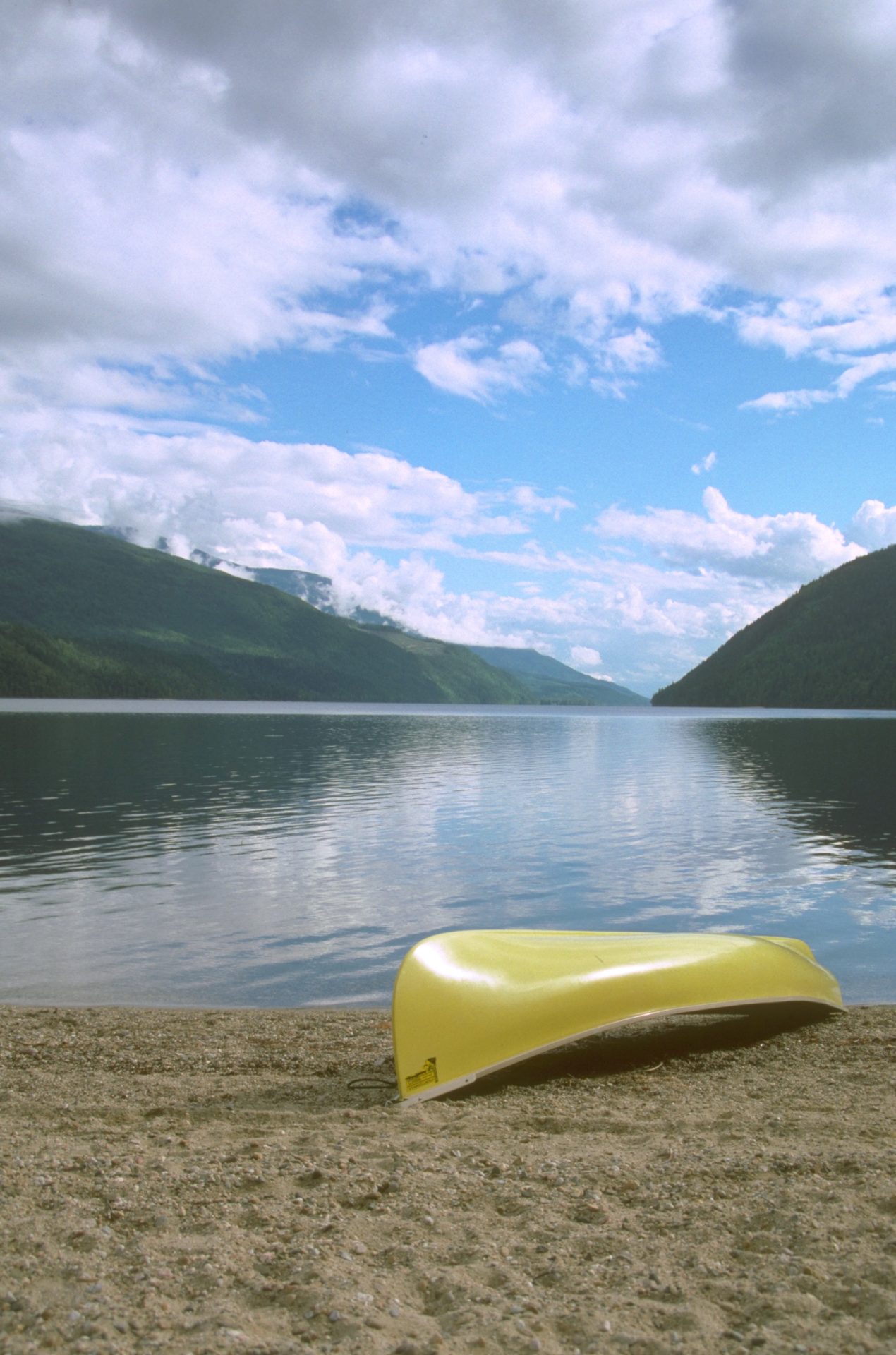 Mabel Lake and the Noisy Creek Recreation Site.
Mabel Lake Road
Beyond the Noisy Creek junction, Three Valley-Mabel Lake Road crosses into the Danforth Creek drainage. Rough side roads lead west into Mount Mara and the Hunters Range and east into Stony, Holiday and Noreen Lakes. Then the backroad parallels Kingfisher Creek valley before making a long, winding descent to Mabel Lake Road and the Shuswap River, approximately 56.5 kilometres from Three Valley Lake.
Kingfisher, at the western outlet of Mabel Lake, is a small resort community that comes alive during the summer. Located where the pavement ends, 37 kilometres east of Enderby and about five kilometres east of the junction with Three Valley-Mabel Lake FS Road, Kingfisher may offer your last chance for supplies if you are following the Wap Lake route north.
Shuswap River Canoe Route
The 36-kilometre route west to Enderby passes through a peaceful, pastoral valley with several access points to the Shuswap River. Canoeists favour the river, and except for the Skookumchuck Rapids near the outlet of Mabel Lake, it is considered rather tranquil and a large breeding ground for Canada geese. The 71-hectare Skookumchuk Rapids Provincial Park was established in 2004 to protect the rapids. The park features steep, rock-sided canyon rapids and pools along a three-kilometre stretch of river.
Kingfisher Interpretive Centre
The Kingfisher Interpretive Centre, approximately 10 kilometres west of the Three Valley-Mabel Lake Road junction, is a good spot to spend an afternoon. The Centre was established almost three decades ago in response to the near extinction of salmon stocks in the Shuswap River. The Centre is a living classroom, offering visitors a chance to study salmon in their habitat.
While camping isn’t permitted at the Kingfisher Centre, it is less than half a kilometre west to the junction to the Cooke
Creek Recreational Site. The 22-site campground is little more than half a kilometre south off the Enderby-Mabel Lake Road. While the Shuswap River water was a bit chilly on a recent October visit, we were able to see the red-bodied sockeye salmon in the river. There were also Fisheries researchers checking out the salmon.
In addition to rustic forest and riverside camping, the site is an important public put-in/pull-out location for river kayakers.
Backroad To Lumby
A junction near the Ashton Creek General Store, 10 kilometres east of Enderby, presents another backroad detour south through the Trinity Valley to Lumby. But if Enderby and Highway 97A is your destination, continue west through the broad Shuswap River Valley and you’ll soon be back at civilization.
Enderby Cliffs
Enderby Cliffs Provincial Park was established in 2006 “to provide increased representation of transitional biogeoclimatic units in the North Okanagan Highlands and North Thompson Uplands ecosections. The area also conserves prominent rock cliffs of the tertiary age. Small, scattered stands of old-growth Douglas fir and larch are found within a variety of successional forests. Sagebrush and rabbit brush occur at uncommonly high elevations.”
A signpost on the north side of Enderby-Mabel Lake Road, approximately two kilometres east of downtown Enderby, marks Brash Allen Road and the main route to Enderby Cliffs Park. According to BC Parks, head north for 1.4 kilometre and stay right where the road forks, continue on the unpaved road for 1.6 kilometre to the parking lot and the Tplaqin Trail head.
The Tplaqin trail winds its way to the summit on a well laid-out and maintained single-track surface. The trail emerges from forest cover in a number of areas, affording hikers sweeping vistas of the valley below, before finally reaching the top of the cliffs and the most impressive view of all. Allow one-and-a-half to two-and-a-half hours each way, more if you are looking for photo-ops.
Ederby
The Enderby-Mabel Lake Road crosses the Shuswap River just east of downtown. There is a visitor centre and a small park just west of the bridge where you can get the latest information year-round. This is also a popular pull-out for those kayaking or canoeing the river.
This also marks decision time. South will take you to Vernon and the North Okanagan. North will take you to the Shuswap and the Trans-Canada Highway.
Statistics
Distance: Approximately 90 kilometres, Three Valley Lake to Enderby
Travel time: Three to four hours
Condition: Some rough gravel; may be closed in winter Season: July through October
Backroads Mapbook: Thompson Okanagan BC
Communities: Revelstoke, Sicamous and Enderby
Additional Information
BC Parks: www.env.gov.bc.ca/bcparks
Enderby & District Chamber of Commerce: www.enderbychamber.com
Kingfisher Interpretive Centre: www.kingfishercentre.com
Okanagan Shuswap Natural Resource District: www.for.gov.bc.ca/dos
Three Valley Lake Chateau Ltd.: www.3valley.com