
When you picture a spring black bear hunt in northern Saskatchewan, you might think of endless stretches of dense timber, winding cutlines and long days listening for the snap of a twig in the bush. What you don’t often imagine is pulling out your phone to check maps, photos and notes with the same ease you’d use to order a pizza back home. Yet that’s exactly what happened on our hunt, where the onX Hunt app became the single most important tool we carried into the field.
Advertisement
From the first day to the final recovery, the app kept us aligned, informed and adaptable in a landscape that demanded quick thinking and flawless communication.
Advertisement
Keeping The Team In Sync
Advertisement
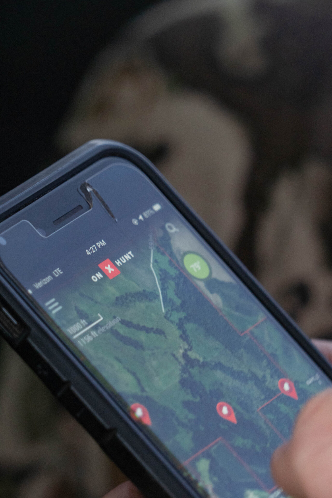
Every hunt begins with scouting, and in Saskatchewan, that means covering a lot of ground. Our group split into smaller teams to check bait sites and monitor bear movement. The most-used feature of the onX Hunt app quickly became shared tracks and waypoints with notes.
Each stand was marked in the app with detailed notes – bear activity, wind direction and stand orientation. Those notes, combined with GPS-logged tracks, were instantly shared with every member of the group. There was no confusion about which stands were active or which routes were easiest. Everyone stayed on the same page without repeating details over crackling radios.
Identifying The Right Bear
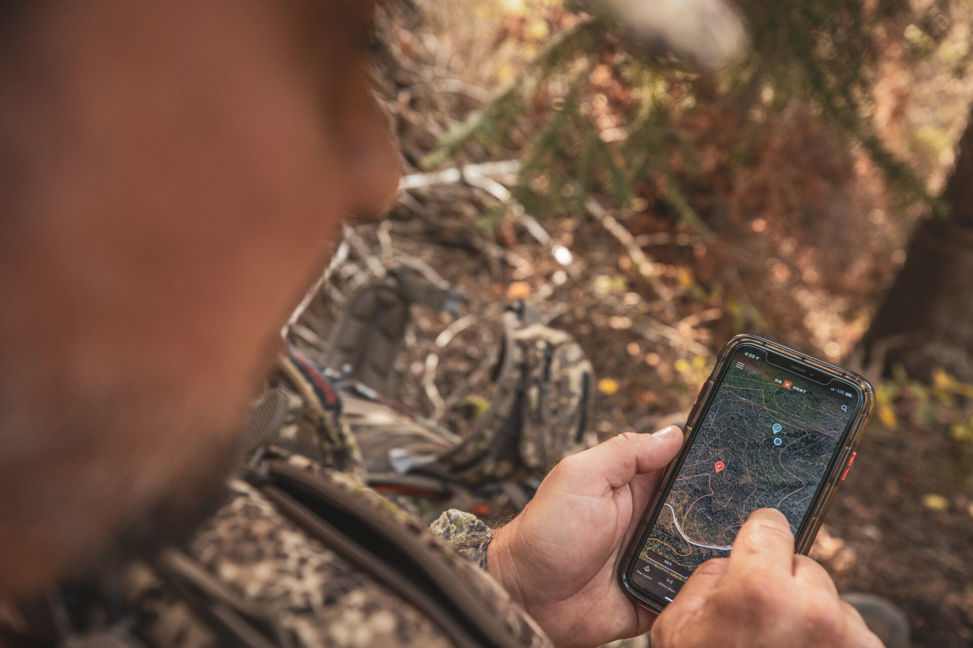
With multiple bears hitting the same bait sites, identification was critical. That’s where the ability to add photos to waypoints saved the day. Every time we checked a trail camera, photos of target bears were attached directly to the relevant stand waypoint.
That meant when we slipped into a blind, we already had a visual reference on our phone of which bear was the shooter and which ones weren’t. No second-guessing, no mistakes – just clear, immediate recall of the right animal at the right location.
Reading The Landscape
Hunting black bears in dense forest can feel like walking into a green wall. Knowing how elevation, timber cuts and waterways interact is the difference between sitting in the right spot and wasting your time.
The onX Hunt app’s aerial imagery and topographic basemaps became our guidebook. By overlaying topo lines on aerial views, we could visualize ridges, low areas and natural funnels. More than once, this helped predict bear movement and understand why certain bait sites produced consistent activity while others didn’t.
Adapting To Fire Restrictions
Midway through the week, a curveball hit. Local fire restrictions banned four-wheeler use due to wildfire risk. That meant access to several stands – normally a quick ride – would now require long hikes through tough terrain.
Instead of guessing which sites were realistic to reach on foot, we used onX Hunt to calculate distances and assess terrain. The app made it clear which stands could be reached in time and which ones needed to be dropped from rotation. This adaptability allowed us to salvage the schedule without losing valuable hunting opportunities.
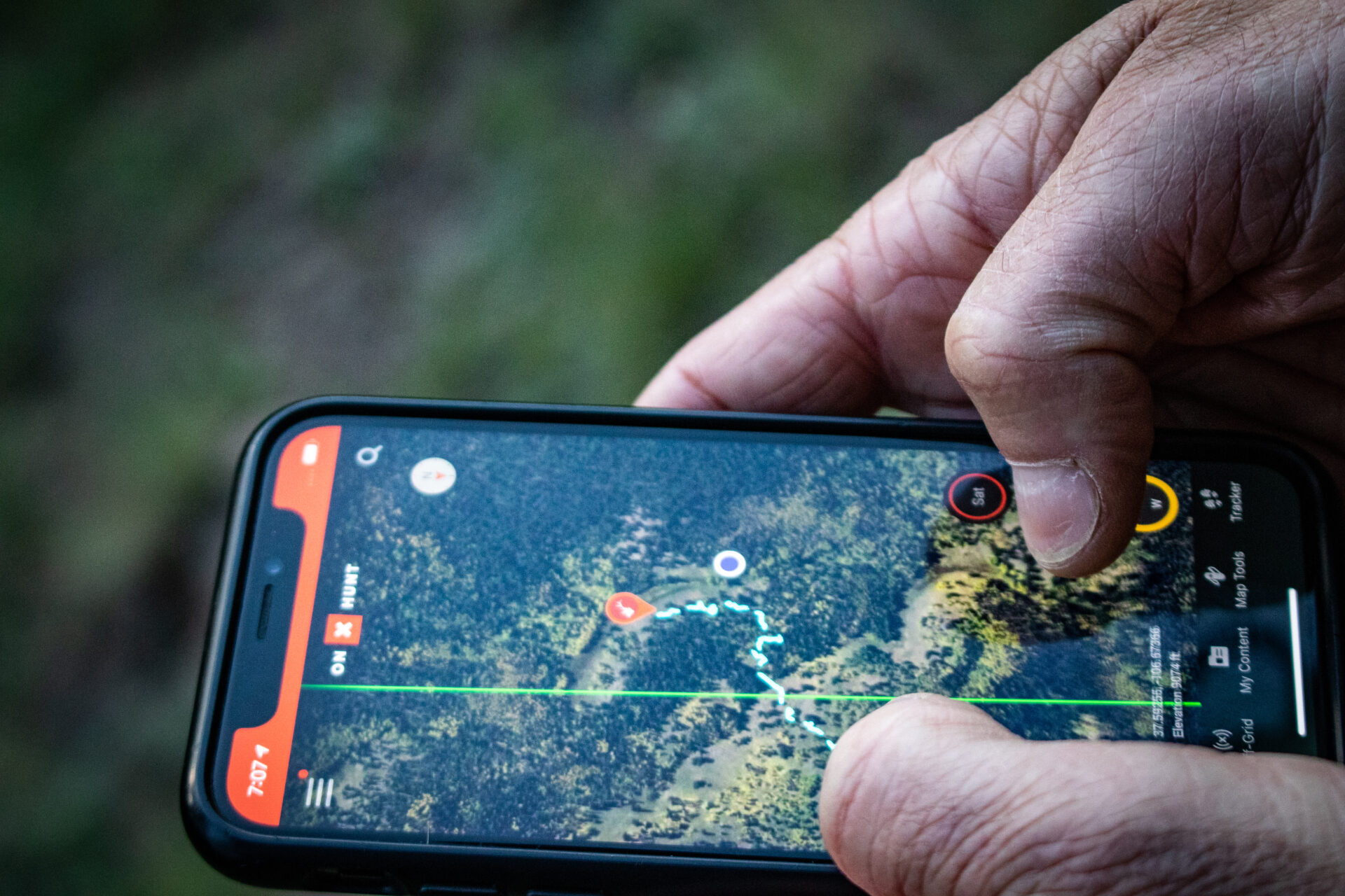
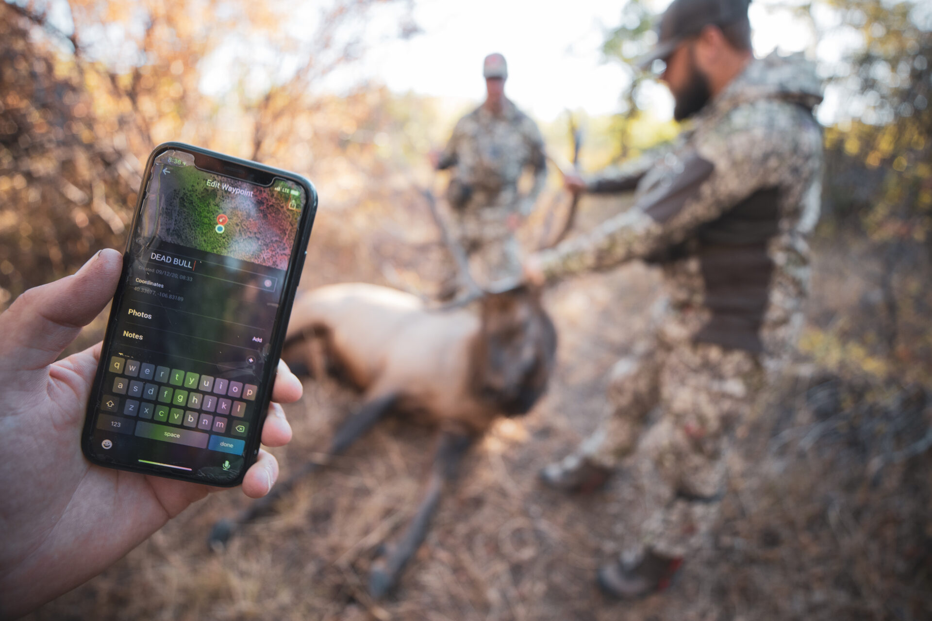
Tracking After The Shot
When an arrow was finally released on a mature boar, the real work began. Blood trailing in heavy timber is often the most difficult part of a bear hunt. Fortunately, onX Hunt’s tracker tool proved invaluable.
The tracker feature allowed us to log the exact route of the blood trail while dropping waypoints on every last blood spot. This meant if the trail became difficult to follow, another team member could join the search and pick up the trail immediately. Even when fading light made visibility poor, the digital trail on the map ensured we never lost direction.
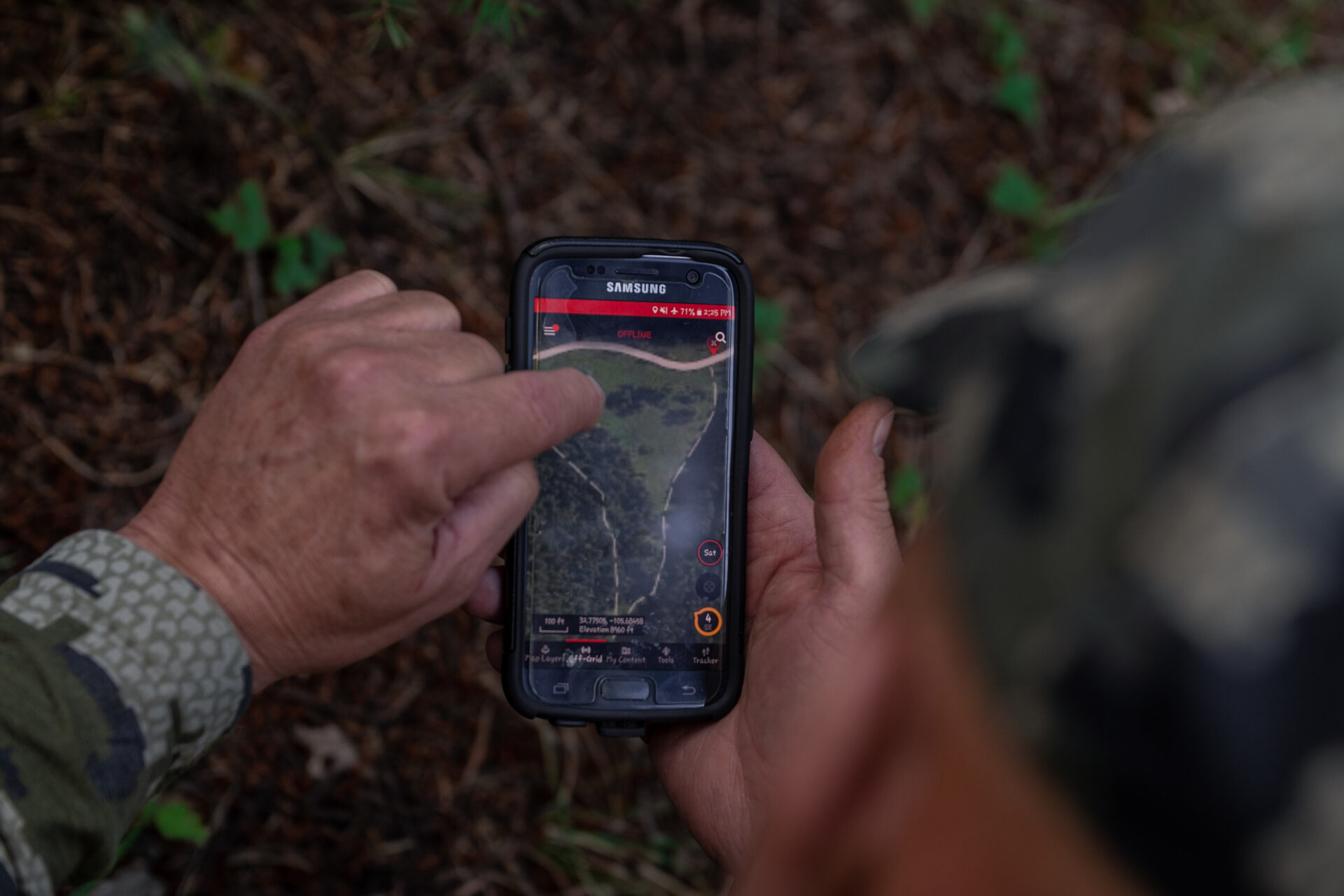
Staying Connected Without Coverage
Much of northern Saskatchewan is well beyond the reach of cell towers. Normally, that means relying on memory, compass bearings or rough printed maps. But with offline maps, every tool in the app remained fully functional.
Because we had downloaded maps ahead of time, we navigated seamlessly in the backcountry without coverage. Stand markers, tracks, photos and notes – all of it was still at our fingertips. The lack of cell service never slowed us down.
Final Reflections
Looking back, this Saskatchewan black bear hunt was more than just another adventure in the woods – it was a case study in how modern digital tools can elevate the hunting experience. The onX Hunt app didn’t replace woodsmanship or instinct; instead, it amplified them.
By keeping the team synchronized, identifying target animals, interpreting terrain, adapting to restrictions and aiding recovery, the app proved itself as more than a luxury. It was a necessity. In many ways, it became as important as a rifle, bow or tree stand.
Hunting has always been about preparation meeting opportunity. This trip reminded us that preparation is no longer limited to what you pack in your bag – it also lives in the digital maps, waypoints and notes you carry in your pocket.
In Canada’s vast wilderness, where cell service fades and challenges appear without warning, the onX Hunt app is more than just handy – it’s the edge that helps you stay ready, responsive and successful in the field.