
Mamit Lake Road
The Mamit Lake Road portion of Highway 97C, in addition to being the main link between Merritt and the copper mines of the Highland Valley, was once the route of gold seekers travelling from the Similkameen to the Cariboo. While there aren’t a lot of gold seekers travelling this route these days, it could still be an alternate route to the Cariboo if you are looking for a change of scenery from the Fraser Canyon.
Advertisement
Mamit Lake Road (also spelled Mamette) leads north from Highway 8 at the First Nations community of Shulus, five kilometres west of Merritt. It passes through dry bunchgrass and sagebrush country before entering scattered timber as it climbs the Guichon Creek valley.
For the sake of this description, consider the junction of Highway 8 and 97C as the starting point and kilometre 0.
Advertisement
Craigmont Mine
Approximately four kilometres north of the Highway 8 junction, the hillside workings of the Craigmont copper mine can be seen across the valley. After more than 20 years of operation, 1982 marked the final year of copper production at the Craigmont mine. Craigmont became a successful mine when it commenced operations in 1961. It continued to be a successful mine through periods of poor copper markets, labour unrest, government policy changes and unprecedented inflation. In an achievement that is unusual in the world of business, Craigmont ended as a successful operation. Craigmont’s success can be measured in the copper produced, the profits made and, most importantly, the people who benefited from the mine and the secondary industry it helped to support.
Advertisement
During Craigmont’s lifetime as a copper producer, it added over 947 million pounds (426 million kilograms) of copper to the world’s marketplace. The mine grossed over $450 million in sales. Production costs included approximately $112 million paid in wages to employees.
After the mine closed, the property lay idle for several years before it was realized that the mine tailings contained magnetite, a mineral that had considerable value in the coal industry. The tailings have been reworked, and the mill property has seen a resurgence of interest in processing other minerals.
Remnants of Glaciation
Mamit Lake Road climbs steadily, gaining about 300 metres before levelling off somewhat near Eight Mile Road. You may catch glimpses of Guichon Creek in the valley bottom to the west. The U-shape of the valley is a bit intriguing, as are the occasional eskers that can be seen as elongated hills on the valley floor near kilometre 25. Both are remnants of the last ice age that melted some 10 to 12,000 years ago.
Several side roads lead to ranches, lakes and logging operations on the plateau country to the east of the valley.
The Mamit Lake area was the Nicola Valley’s French district. The brothers, Charles, Laurent, Joseph and Pierre Guichon, came from France in 1861 to mine in the Cariboo. Charles returned to France while the others settled in the area in 1873. They were later joined by Louis Quenville and Jean and François Rey. As an aside, Joseph Guichon later established a ranch on the northeast shores of Nicola Lake and, in 1907 to 1908, built the famous Quilchena Hotel.
Left Field Cider Co.
A minute or two past the eskers, (kilometre 26.5) you should see a young apple orchard and some buildings on the left (no surprise). While an apple orchard at this elevation (975 metres) may be a bit of a surprise, what is even more surprising is that this is the home of the Left Field Cider Co. Two sisters, Theresa and Kate, descendants of a pioneer family, head up the operation that began production of traditional-style apple cider in 2011 – after several years of experimentation and extensive training.
Despite its unusual location, the Left Field Cider Co. has won awards for their product. Their story is on their web page at www.leftfieldcider.com, and their cider is widely available, including at the Empty Keg Brew House and Brambles Bakery & Café in Merritt. If you are making this trip during the summer, their ciderhouse tasting room is open Fridays from 3 p.m. to 7 p.m. and Saturday and Sunday from noon to 6 p.m.
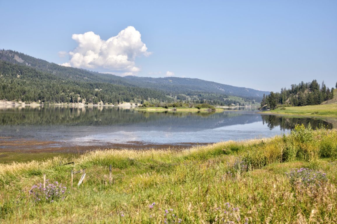
Mamit Lake
Five-kilometre-long Mamit Lake, within sight of the ciderhouse, is surrounded by timber on the west and grassland slopes on the east. The marshes on the north and south ends are home to resident and migrating waterfowl. On a spring visit, you may see a dozen species of birds and several hundred Sandhill cranes.
There are a couple of pull outs near the north end of the lake, where you can safely get off the highway and launch a cartop boat in search of wild rainbow trout.
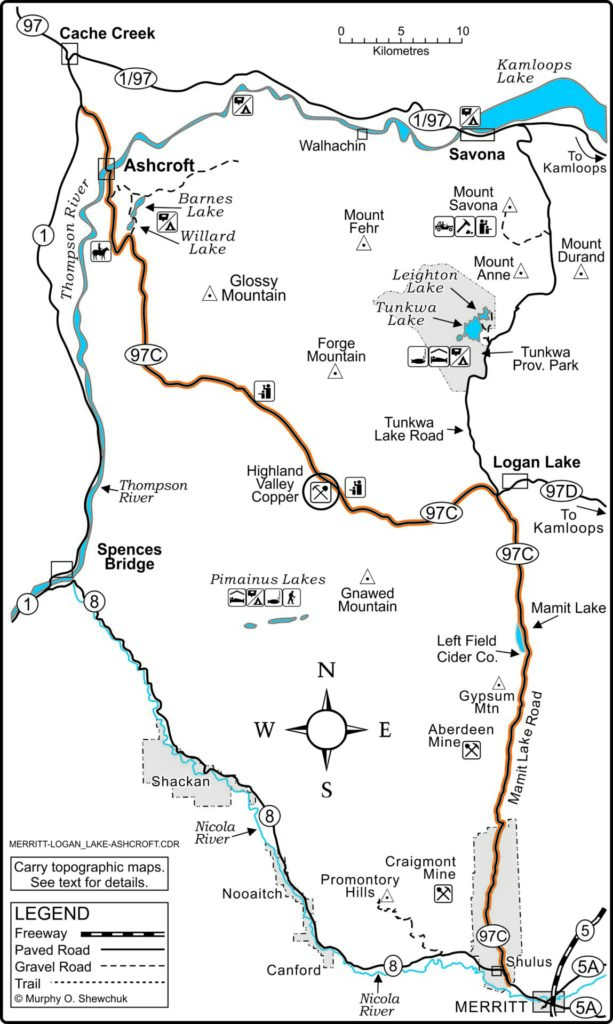
Highway 97C continues north through the grasslands that dominate the west-facing slopes, passing BC Hydro’s Highland Substation. If you are interested in picturesque old buildings and fences, there are some prime examples about seven kilometres north, just before you cross Meadow Creek.
 A pioneer homestead along Mamit Lake Road.
Logan Lake
The junction of Highway 97D at kilometre 42 marks a time for a decision. Straight ahead is Tunkwa Lake Road, a backroad to Savona, on Kamloops Lake. There are camping opportunities at Tunkwa Provincial Park, approximately 15 kilometres to the north.
To the right is Logan Lake, a community that has seen more than its fair share of ups and downs. Because of the nearby Highland Valley mines, its fate has been tied to the vagaries of world copper prices. Logan Lake District Council has attempted to diversify the community employment base and the village tax rolls. Logan Lake has been successful in encouraging retired people to move into the relatively low-cost housing. It has also been successful in creating a recreational environment that would be the envy of other communities of similar size.
Cross-country skiing has become a major winter pastime. The cross-country ski trail network starts near a television tower above the village and extends to the north. At the time of writing, the Highland Valley Outdoor Association had 36 kilometres of groomed cross-country trails, including two kilometres of lighted track. The system has something for everyone, with beginner trails near the community and a mixture of intermediate and advanced trails throughout the network.
Logan Lake is an opportunity fill the fuel tank and stock up on groceries. It also has a campground and golf course. If you want a sneak peek at the giant ore trucks and shovels used at the Highland Valley Copper mine, there is one of each on display at a park near the community centre.
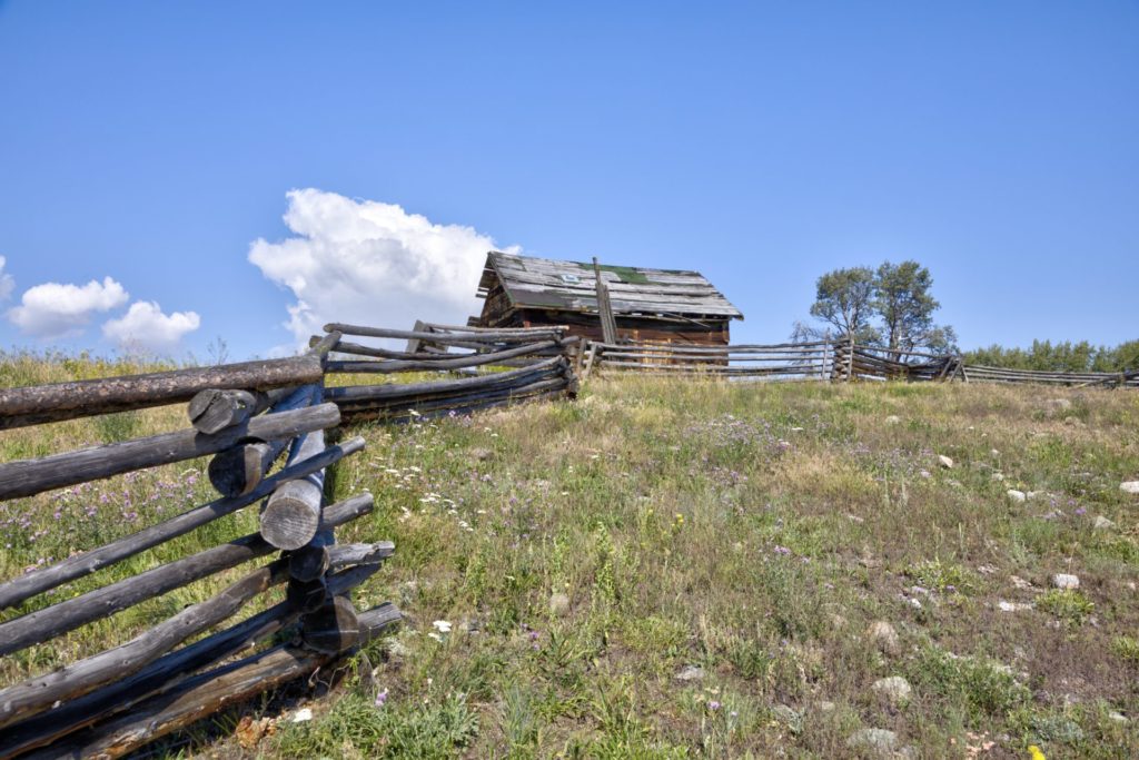
 Highland Valley Copper mine.
Highland Valley Copper
Highland Valley Road (97C) links the District of Logan Lake with Ashcroft, on the Trans-Canada Highway. This scenic drive climbs gradually into the giant ancient volcanic crater that is the Highland Valley. Approximately 16 kilometres west of Logan Lake, the road passes the former Lornex and Bethlehem Copper operations — now part of Highland Valley Copper, North America’s largest copper mine.
With the first claims in the Guichon batholith staked in 1896, mining and exploration proceeded sporadically for more than a half century before technological developments made mining of the low-grade deposit profitable.
- H. “Spud” Huestis and his associates formed the Bethlehem Copper Corporation in the mid-1950s. Bethlehem Copper began an intensive exploration program that established copper/molybdenum ore reserves exceeding 60 million tonnes at approximately five per cent copper. After several attempts at financing, Japan’s Sumitomo Metal Company invested $5.5 million, and on Dec. 1, 1962, Bethlehem Copper began production.
Lornex Mine
Egil Lorntzsen, another British Columbia mine-finder of note, first staked claims in 1958 to 1959 on what became the Lornex Mining Corporation property (now part of Highland Valley Copper). It took more than a decade before a $144 million construction program led to Lornex’s first shipment of copper concentrate in July 1972. In its first decade of operation, Lornex expanded to become a giant open-pit mine employing 1,100 people. It used some of the world’s largest mining equipment, including specially designed 235-tonne capacity, rubber-tired haulage trucks.
Highmont Mines
In 1980 to 1981, Highmont Mines went into production east of the Lornex pit. Plans were also underway for an even larger mine on the valley floor, on claims owned by Valley Copper (Cominco). After hundreds of millions of dollars were spent, Valley Copper did come on line, but with a new name and new partners. Cominco, Lornex and Highmont combined to form Highland Valley Copper. The Lornex mill was expanded by moving the Highmont Mill to the Lornex site.
At the time of writing, Highland Valley Copper was the largest copper mine in Canada and one of the largest copper mining/concentrating operations in the world. Copper production in 2019 is anticipated to be between 115,000 and 120,000 tonnes, with production increasing over the next decade.
There is a viewpoint just north of Highway 97C, about 2.5 kilometres west of the main mine entrance. Beyond the viewpoint, the road climbs steadily northwest, offering views of the giant mine tailing pond and the distant Coast Range Mountains. Then, after reaching the height-of-land, it begins the steep descent into the semi-desert country surrounding Ashcroft.
Barnes Lake
Approximately 10 kilometres northwest of the summit, the Highland Valley Road takes a sweeping switchback turn to the left. Half way around the turn, Barnes Lake Road heads north to Willard Lake and Barnes Lake. There are recreation sites on both lakes, with a campsite and boat launch on Barnes Lake.
John Christopher Barnes was one of the founders of the village of Ashcroft. He was born in Kentucky in 1829 and followed the California Gold Rush west in 1849. When that rush waned in 1858, he was one of the first of the thousands of prospectors to head to the Fraser River. He tried his hand as a prospector, cowboy and gambler, but soon, with William Brink, began running pack trains to the Cariboo.
After a sudden snowstorm near Barkerville that trapped their animals and nearly finished them off, they decided to head to a warmer climate. In 1863, they pre-empted land in what is now the Ashcroft area where they established a ranch and raised vegetables and fruit.
Brink died in 1879, but Barnes continued to acquire more land. He realized the need for irrigation water and in the mid-1880s built a dam across a creek that was to create what is now known as Barnes Lake.
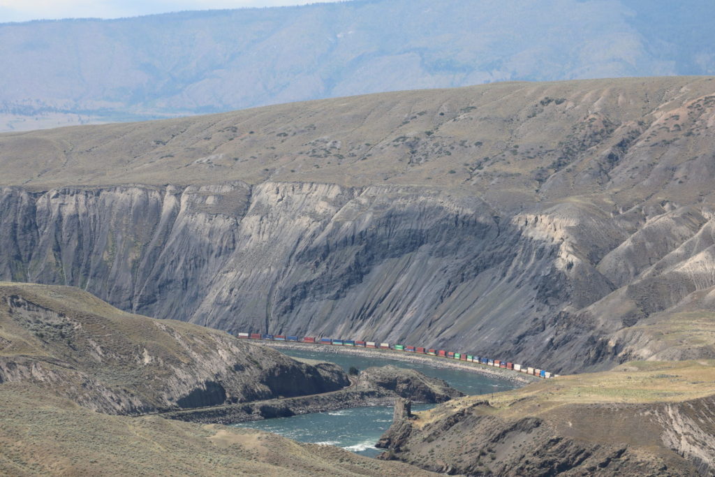 Black Canyon and the Thompson River.
Sundance Guest Ranch
Another two kilometres and another switchback turn, and you should see Kirkland Ranch Road on the left. If you are tired of camping and your own cooking, Sundance Guest Ranch offers fine food and accommodation and enough horses to more than equip your whole family.
As you continue the descent to Ashcroft, look for the Thompson River and the Black Canyon to the west. It may not look like much from Highway 97C, but if you get the opportunity, join Kumsheen for a rafting adventure from Ashcroft to Spences Bridge. The canyon gets its name from the 150-million-year-old sedimentary rock wall that rises vertically from the west side of the river.
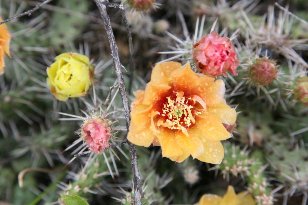 A prickly pear cactus showing off its petals near Ashcroft.
Ashcroft
After a 17-kilometre descent, Highland Valley Road enters downtown Ashcroft. The village owes its location to the Canadian Pacific Railroad and men like Barnes. When the railroad was completed in 1885, Ashcroft became mile 0 of the Cariboo Wagon Road and Barnes’ hotel served the freighters and travellers heading to the goldfields.
While John Barnes’ hotel is long-gone, the village still offers plenty of amenities to make your visit worthwhile. There is a hotel on the banks of the Thompson River and a fine museum in the old downtown area.
If you are interested in a pleasant outdoor stroll through time, Ashcroft’s Heritage Place Park is well worth the visit. You’ll find a railway caboose, mine cars, a replica of a waterwheel used to drive a pioneer flour mill, and other historical items. Picnic tables and welcome shade also make this a pleasant place to relax.
Desert Hills Ranch
As you climb northward out of Ashcroft, following Highway 97C up to Highway 1 just south of Cache Creek, you can’t help but notice the cultivated fields on either side of the road.
They weren’t always here. When Barnes first arrived, the sagebrush-covered benches barely supported a few hardy cattle. The agriculture potential wasn’t fully realized until the First World War when Wing Chong Tai led the development of large vegetable farms utilizing expert Chinese irrigators and water from the Bonaparte River. They shipped hundreds of rail carloads of potatoes, white beans and onions. They built a cannery a decade later and ordered one million labels during their first year.
Canada began importing cheaper US vegetables after the Second World War and the cannery finally closed in 1957. The productive fields returned to sagebrush and hayfields until a couple of decades ago when Desert Hills Ranch began a modest experiment to revive the vegetable operation. Now with huge greenhouses and vegetable fields as far as you can see, they supply produce to much of western Canada. I even heard a rumour that they ship their melons to China.
You can stock up at their Ashcroft location year round, or at a smaller store just north of Cache Creek in the fall.
Trans-Canada Highway 1
It is six kilometres from the Ashcroft bridge to Highway 1 and the northwest end of Highway 97C. The cultivated fields on the right are sharp contrast to the semi-desert on the left and the fire-scarred hills across the highway, a stark reminder of the 2017 Elephant Hill wildfire.
You have several choices. You can head north to Cache Creek and then north to the Cariboo or east to Kamloops. You can also head south to Spences Bridge and beyond.
Statistics
Distance: 44 kilometres, Highway 8 at Shulus to Logan Lake; 60 kilometres, Logan Lake to Ashcroft.
Travel time: Two to three hours.
Condition: Paved throughout.
Season: All seasons.
Backroad Mapbook: Thompson Okanagan BC.
Communities: Merritt, Logan Lake and Ashcroft.