
If you are looking for a scenic drive that includes century-old cities, alpine trails, a free ferry and plenty of camping and photo opportunities, consider taking Highway 3A from Castlegar to Creston via Nelson and the Kootenay Lake ferry. It will add at least 40 kilometres and two hours to your trip, plus whatever side trips you make. If you are easily distracted, allow at least a day or two to make the trip.
Advertisement
 Doukhobor Discovery Centre in Castlegar.
Castlegar
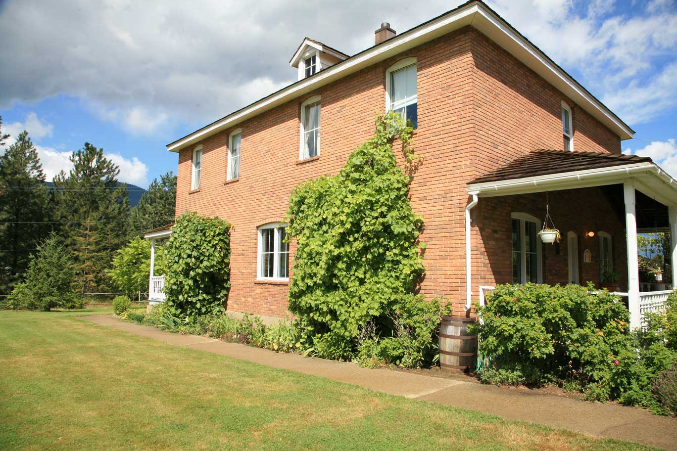
Castlegar is the second largest city along Highway 3 in the Kootenays. It is also a good place to learn more about the Doukhobor people who settled here in the early 1900s. The Doukhobor Discovery Centre, a few minutes north of the Highway 3A junction with Highway 3, could be a good place to start off your Kootenay heritage tour. The centre is a reconstruction of a typical Doukhobor village, as lived in from 1908 to 1939, showing all of the major buildings, tools, handicrafts and implements used at that time. Open seasonally from May 1 to Sept. 30.
Advertisement
While Castlegar is easily bypassed on Highway 3 or 3A, it is well worth a tour through the commercial district and the old downtown core. There are plenty of places to stock up and a few interesting distractions, such as Zuckerberg Island Heritage Park.
Kootenay River
Advertisement
Highway 3A crosses the Kootenay River about three kilometres north of the junction and stays on the north side for most of the way to Nelson. Keep a close eye on the river and you may catch a glimpse of the West Kootenay Power hydroelectric dams that harnessed the river for well over a century. The first of these, the Lower Bonnington Dam, was built in 1897 and upgraded in 1924 and 1964. The Upper Bonnington Dam was originally built in 1907 and also upgraded a couple more times. The Cora Linn Dam, about 15 kilometres downstream from Nelson, was initially built in 1932 to increase storage capacity and generation.
They were initially built to supply electric power to the mines at Rossland and the Trail smelter. They also served the local communities, and the Sullivan Mine at Kimberley.
BC Hydro got into the local hydroelectric game with the Kootenay Canal Project. Completed in 1976, it is capable of generating 583 megawatts by diverting water from the Cora Linn reservoir and putting it through four turbines before discharging it back into the Kootenay River. In a massive case of reuse and recycle, this extra generation is made possible by the water storage created by the Duncan Dam north of Kootenay Lake, and the Libby Dam on the Kootenay River in the US.
Nelson
Film director Fred Schepisi recognized Nelson’s unique heritage when he brought in Steve Martin, Daryl Hannah and the crew for the filming of Roxannein 1986. With the popularity of the movie, the rest of North America quickly became aware of the jewel that Nelsonites had worked long and hard to polish.
Nelson, the “Queen City of the Kootenays,” is built on a mountainside in south-eastern BC’s Selkirk range. And like its street system, Nelson’s economy has had more than its fair share of ups and downs.
Nelson’s history began with the gold rush of the 1860s, but the prospectors had nearly all left when immensely rich silver-lead-zinc deposits were discovered in the nearby Selkirk Mountains. Nelson’s strategic location made it an ideal terminal for rail and sternwheel shipping and the community quickly grew into a major centre.
Hugh Nelson
Contrary to many a visitor’s first guess, Nelson’s namesake was not Lord Nelson of British Admiralty fame, but Hugh Nelson, a gold rush businessman who played an important role in BC’s entrance into Canadian confederation. Nelson was the delegate from Burrard Inlet at the historic 1868 Yale Convention that called for BC’s immediate union with Canada.
John “Truth” Houston
A monument on the corner of Vernon and Ward Streets memorializes Nelson’s doughty, flamboyant first mayor. John Houston was a figure of controversy, but to many old-timers he was the founding genius of the city. As the forthright editor of the city’s first newspaper, the Nelson Miner, and later, the Nelson Tribune, in 1897 he boldly urged the straggling mining camp to incorporate. According to a rival newsman, Colonel R.T. Lowery, Houston galvanized into action a population made up of “mule skinners, packers, trail blazers, remittance men and promoters with a slight trace of tenderfeet.”
Houston went on to win the election and held the office in 1897, 1898, 1900 and 1905. In addition to making his mark in Nelson, Houston Lane in Prince George, and the town of Houston in northern BC, are named after him.
Heritage Capital
Despite its small size, Nelson is a veritable historical storehouse. More than 350 turn-of-the-century buildings make Nelson second only to Victoria and Vancouver for architectural treasures. Nelson’s isolation from the rest of Canada and its nearness to Spokane meant that the early architecture had an American influence more typical of San Francisco, Seattle and Spokane than Upper Canada. A notable exception is the Nelson Court House on Ward Street. This impressive stone structure was designed by Francis Mawson (F.M.) Rattenbury, the architect who is famous for BC’s parliament buildings and the Empress Hotel in Victoria.
It was this concentration of heritage buildings that impressed Fred Schipisi and the crew of Roxanne. And it was the release of the film that drew visitors and reinforced Nelson’s determination to become a vibrant, diverse community.
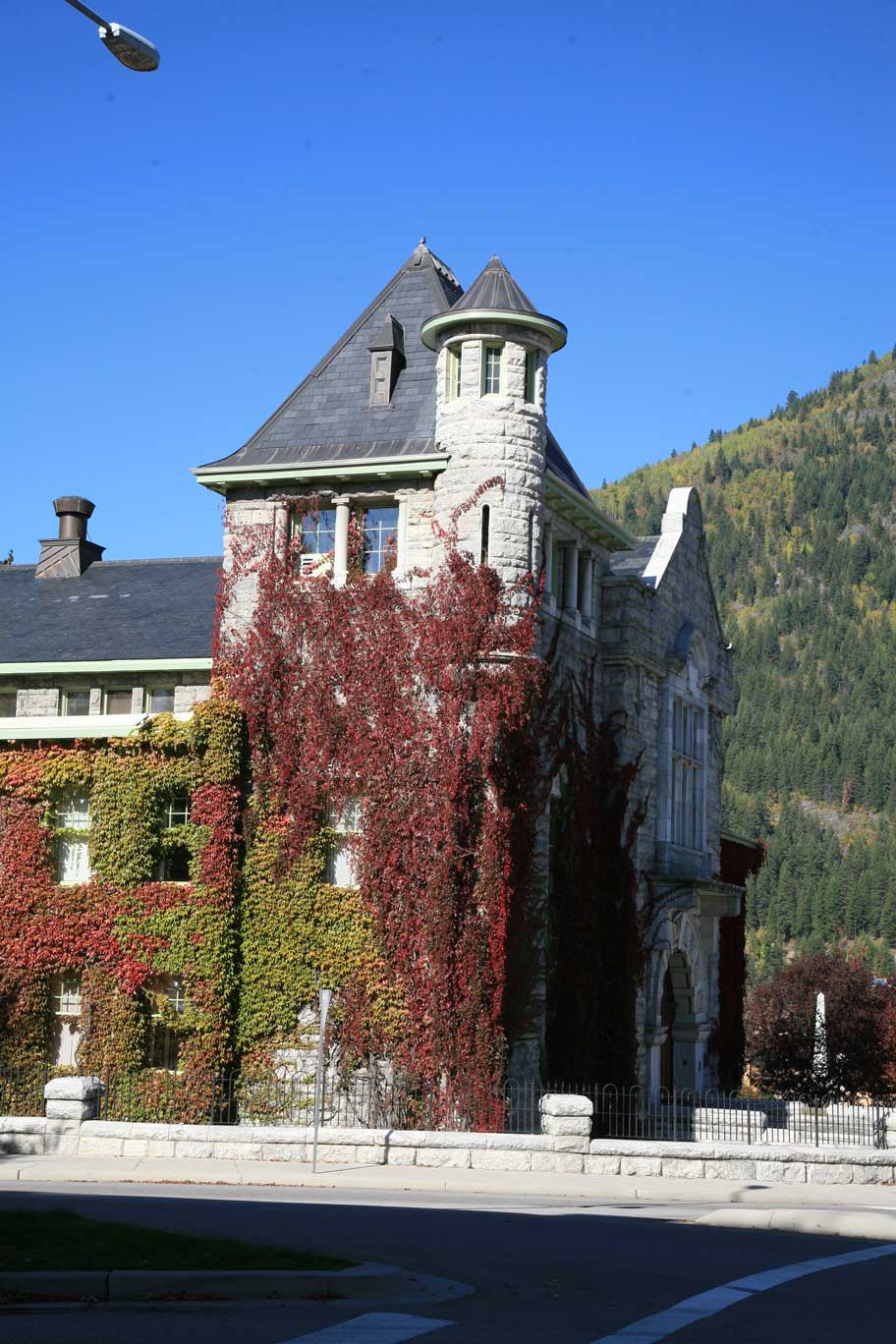 Downtown Nelson is home to many century-old buildings.
Plan To Stop
Highway 3A follows much of Front Street through downtown Nelson. The Visitor Information Centre is just south of the highway, as are many of the architectural treasures. You may be able to pick up a heritage walking tour pamphlet there to help you identify the magnificent buildings.
While you are toting your camera around the downtown, the rest of the family may want to visit Chahko Mika Mall or ride the Nelson Electric Tramway along the waterfront. Streetcar #23 is a fully functional streetcar that was used in Nelson in the first half of the 20th century. It usually operates seven days a week from mid-May to Thanksgiving.
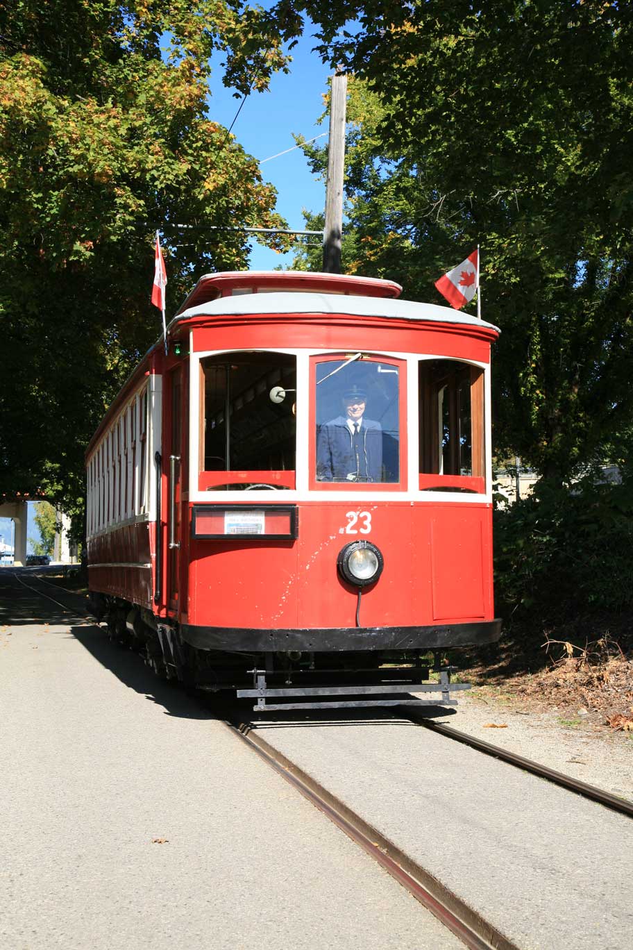 Be sure to hop aboard streetcar #23 in Nelson for a historic ride.
Nelson’s Big Orange Bridge
The West Arm Bridge at Nelson was officially opened on Nov. 7, 1957, by Premier W.A.C. Bennett and Highways Minister P.A. Gaglardi, flanked by numerous dignitaries and serenaded by pipers and drummers of the Kootenay Kiltie Band. It replaced a ferry that had long been outstripped by the local and interprovincial traffic.
It is also your only way to continue east on Highway 3A.
Kokanee Creek Provincial Park
Highway 3A follows a winding route along the north shore of Kootenay Lake, flanked on both sides by stately homes and lakeshore cabins. Don’t expect to make time along this route.
Kokanee Creek Provincial Park, 20 kilometres northeast of downtown Nelson, is the first major stop along the way to the Kootenay Lake Ferry slip at Balfour. At 260 hectares, it isn’t a big park, but what it lacks in size it makes up for in lakeside diversity with over a kilometre of beach and 170 campsites in three vehicle-access campgrounds. The campsites are generally in the trees, with a variety of trails that access the beach or meander along Kokanee Creek where the spawning land-locked salmon can often be seen from August to October.
Kokanee Glacier Provincial Park Road
Half a kilometre east of the main entrance to Kokanee Creek Park is the entrance to a steep, rough gravel road that could take you 16 kilometres north to Gibson Lake and the start of the many trails in Kokanee Glacier Provincial Park. The BC Parks Kokanee Glacier Provincial Park website has a host of suggestions to make your drive up safe and your adventures in the park enjoyable. There isn’t any vehicle camping in the park — you will have to settle with Kokanee Creek Park at the foot of the road to the alpine.
With some of the glacier high points reaching 2,800 metres (9,200 feet), the mountains grab the moisture being carried eastward from the Arrow Lakes and Slocan Lake. The result is obvious – snow and ice in the alpine. And roads that can be impassable from October to July.
Balfour Ferry Terminal
It is another dozen kilometres east to the Balfour Ferry Terminal and the Kootenay Lake Ferry. At the time of writing, there was talk about moving the terminal to reduce congestion. In the meantime, the eight-kilometre, 35-minute trip is considered to be the longest free ferry ride in the world. The MV Osprey 2000 operates year-round and the MV Balfour adds extra sailings in the summer months. Sailings are usually from 6:30 a.m. to 10:20 p.m., with food services available on the MV Osprey 2000.Check current schedules for up-to-date information and BC Highways reports for delays during the busy summer months.
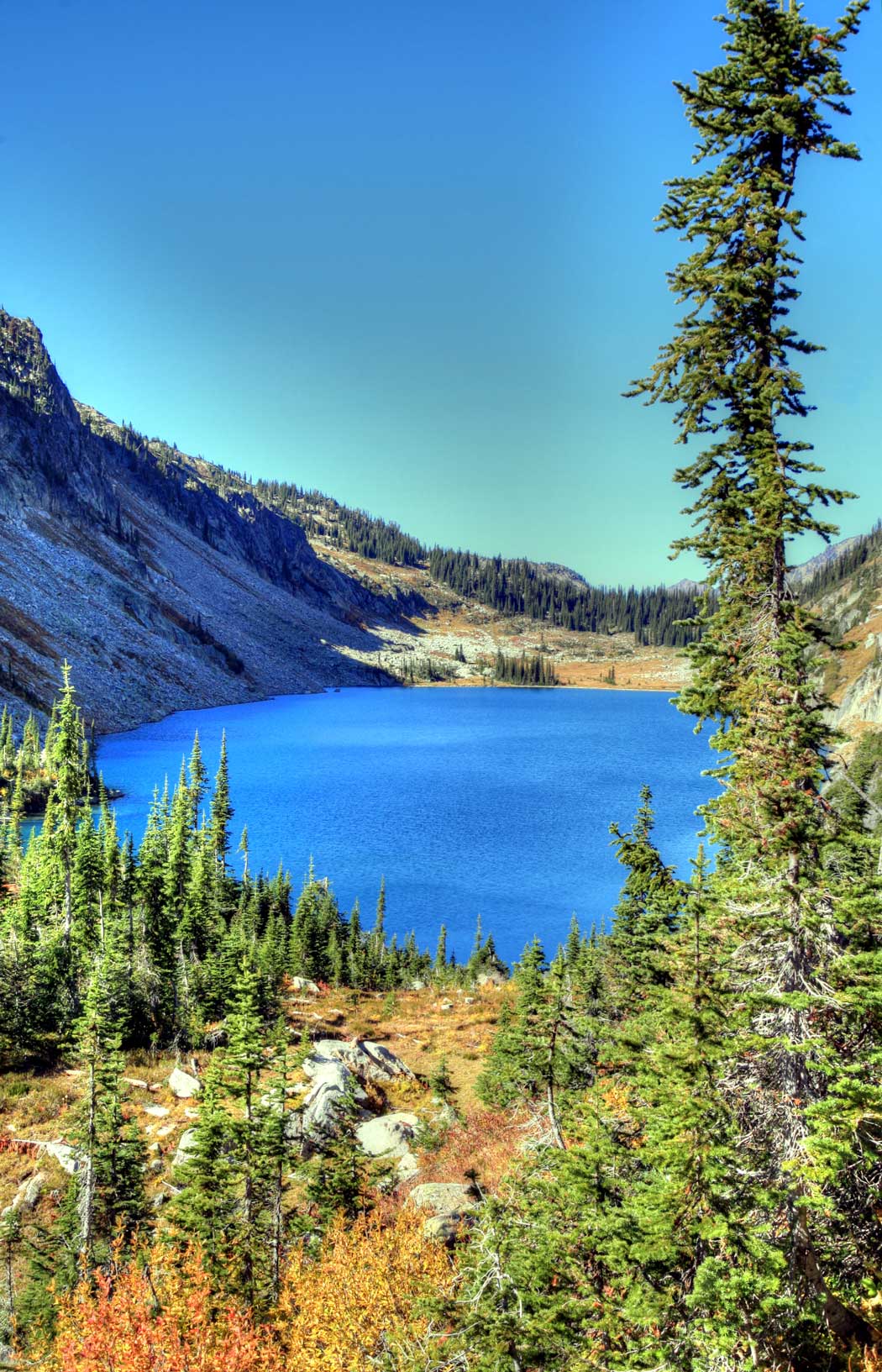 Beautiful Kokanee Lake.
Riondel Road
The east terminal of the Kootenay Lake Ferry is at Kootenay Bay and Riondel Road is a bit over a kilometre northeast of the ferry slip. The mining community that once was home to the famous Bluebell mine is 10 kilometres farther north.
A stop-of-interest sign in the heart of the community indicates that the Bluebell Mine had a bit of a rocky start. In 1882, an American named Robert Sproule staked four claims at this location, including the Bluebell. When he left to register his claims, an Englishman, Thomas Hammill, re-staked the claims. Sproule lost the resulting dispute and in a fit of rage, shot Hammill. Sproule was convicted and hanged for the murder.
The Bluebell Mine operated from 1895 to 1929, when it shut down. The operation reopened in 1950 and continued to 1972. Since then, the community has become a retirement centre. The Riondel Community Campground, located on the shore of Kootenay Lake, is operated by a non-profit society during the summer months. More information is available on their website at http://riondelcampground.ca/.
Pebble Beach Recreation Site
If you are looking for a bit more privacy, there is a small walk-in or boat-in BC Recreation Site at Pebble Beach, about five kilometres north of Riondel. Take Riondel North Road to Tam O’Shanter Creek and continue north on Kootenay Lake Forest Service Road.
There is another larger recreation site a further five kilometres north. The Bernard Beaches (Garland Bay South) rec site has road access and 18 campsites. There is another rec site at Garland Bay with 22 campsites. Both sites are maintained with $12 camping fees during the summer months. Check the Recreation Sites and Trails BC website at http://www.sitesandtrailsbc.ca/ for more information on the access road.
Back on Highway 3A
Crawford Bay, another five kilometres southeast, is well worth a stop to explore and camp. This is an artisan community and the North Woven Broom Co., located in a historic log barn alongside the highway, is hard to resist. Here you can get brooms woven with antique equipment using natural broom corn and handles made from a variety of wood. The ironwork comes from the Kootenay Forge, also here in Crawford Bay. It doesn’t take much imagination to visualize a witch riding an untrimmed broom off into the midnight sky.
If you are looking for a place to spend the night, there are RV parks and chalets. The Kokanee Chalets RV Park backs on the woodland with a trail down to a marsh and the bay.
Gray Creek
After passing through the Crawford Bay community, Highway 3A follows the east shore of Crawford Bay and Kootenay Lake southward, with the next potential stop and diversion being at Gray Creek.
No tour through the Kootenays is complete without a stop at the Gray Creek Store. In business since 1913, it has pretty well everything you might need to cover your butt, feed your face or build a roof over your head. Their motto “If we don’t have it, you don’t need it!” fits to a tee.
If you are interested in an 85-kilometre scenic tour that could take you over Gray Creek Pass to Kimberley, the Gray Creek Store is an ideal place to stop for the latest information.
Cliffside Views
Highway 3A continues south, sometimes dropping down to lake level and sometimes climbing well above the rocky points. If you find yourself being caught up in the southbound ferry traffic, find a spot to pull over and let the “madding” crowds go by. You will find the drive much more relaxing when you aren’t blocking the way of those in a hurry.
Lockhart Creek Provincial Park
Located about 15 kilometres south of Gray Creek and 40 kilometres north of Creston, Lockhart Beach Provincial Park is one of the few public campgrounds along the south arm of Kootenay Lake. The 18 first-come, first-served campsites are located in the trees a short walk from the sandy beach. As with most BC Parks, self-sufficiency is the key to enjoyment and survival.
If you are interested in a longer hike, there is a well-maintained trail to the east along the north side of Lockhart Creek. On one autumn trip through the area, we were pleasantly surprised to view Kokanee spawning in the creek.
Duck Lake
There are numerous viewpoints and potential stops between Lockhart Creek and Creston, but the last major detour is to explore Duck Lake and the marshes at the south end of Kootenay Lake – part of the Creston Valley Wildlife Management. Watch for Lower Wynndel Road to the west, about eight kilometres north of the junction with Highway 3. Follow it south for half a kilometre and look for a tricky turn down the hill to the west. Then take Duck Lake Road west for another kilometre. After crossing the bridge over the channel, take Channel Road to the right (north) along the west side of the channel. It is about 7.5 kilometres to Duck Lake and the narrow gravel road ends about 2.5 kilometres later.
The road is gated near Duck Lake and the gate may be closed during the sensitive nesting season. Regardless, you could have some excellent opportunities to view and photograph the wildlife that call the rich marsh home.
Creston
With a town population of roughly 5,500 people, the available services seem to outweigh what the town might demand. However, its location in an important agricultural area and on a major highway seems to support the diversity of stores and other facilities. Creston-based Columbia Brewery, home of world-famous Kokanee beer, has been supplying that broader market since 1959. Available throughout BC for decades, Kokanee lager and Kootenay True Ale has recently reached as far east as Newfoundland and Labrador.
Creston’s unique landmark is the pair of grain elevators on the western edge of downtown. Dating from the mid-1930s, they are said to have operated until the 1980s.
Creston is also decision time. Do you head east to the Rockies or west over Kootenay Pass to Salmo and Castlegar and complete a circle tour. The decision is yours, but don’t forget to stop at the Creston Marsh.