Hunters across Canada know that our wilderness is unlike anywhere else in the world – vast, untamed and rich with opportunity. But with that wildness comes complexity: patchwork land ownership, inconsistent map access and limited connectivity in the backcountry. That’s why the launch of onX Hunt Maps tailored specifically for the Canadian market is turning heads this season. After years of dominating the American hunting scene, onX has brought its powerful GPS and mapping technology north of the border, giving Canadian hunters a sophisticated new tool built for our unique terrain.
Advertisement
A New Era Of Mapping The Wild
Advertisement
onX Hunt’s Canadian edition finally gives us what we’ve long been waiting for: detailed, accurate and offline-accessible maps that show who owns what and where you can legally hunt. The platform now includes Crown and public land overlays for all provinces, Special Draw Zones in Alberta and BC and Saskatchewan Furblock Units, just to name just a few of the newly integrated data layers.
For years, Canadian hunters have juggled paper maps, government PDFs and secondhand knowledge passed around hunting forums. Now, with onX Hunt, it’s all in one place. Want to know if that section of forest is accessible public land? One glance tells you. Need to plan a backcountry trip in an area impacted by wildfire? onX offers historic fire overlays and even crop distribution maps that help identify prime game habitat. Whether you’re scouting for elk in BC or deer in Ontario, onX gives you the intelligence you need to hunt smarter.
Advertisement
And the mapping available will only get better. “We’re working to improve our private land ownership database,” explained Dylan Dowson, marketing manager for onX. “All of this data exists out there, but it’s a lot of work to find it and put it together. So that’s our priority.”
The Power Of Offline
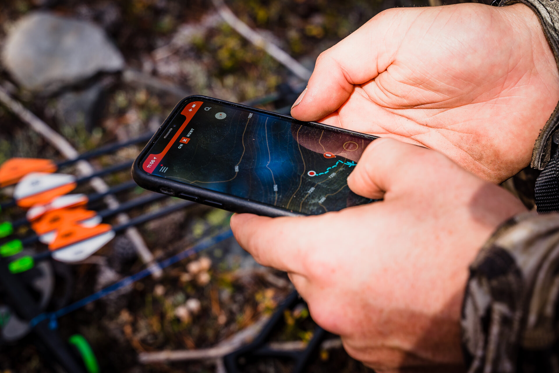
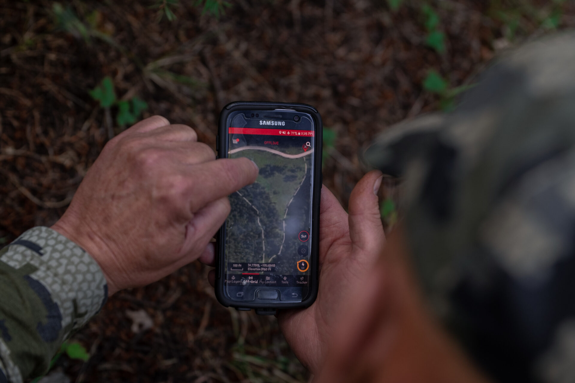
One of onX’s strongest features – and a critical one for Canadian users – is the ability to download high-resolution offline maps before heading into areas with no cell service. Users can access 2D topo maps, satellite imagery or hybrid views, all synced directly to their devices. Your GPS location remains live and accurate without data, ensuring you can always find your way, whether you’re navigating thick bush or open prairie.
Paired with TerrainX 3D, a feature that provides exaggerated elevation models, onX gives hunters a way to scout ridge lines, valleys and bedding areas before even lacing up their boots. What was once guesswork is now a calculated plan.
Tools Built For The Hunt
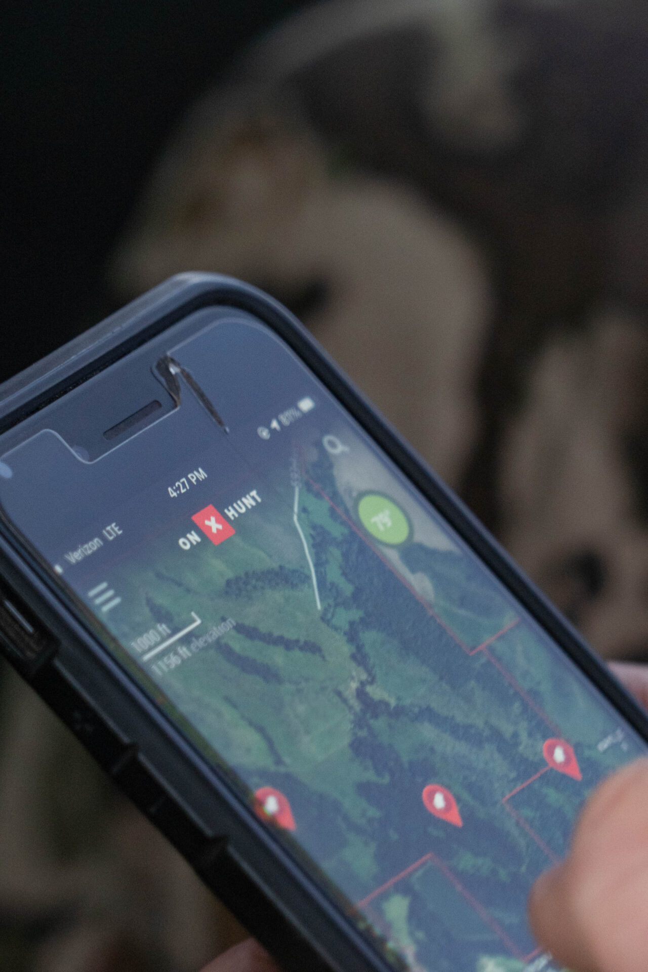
But onX isn’t just a map app – it’s a hunting system. The app includes tools designed to improve safety, communication and tactical planning in the field. You can mark waypoints for trail cameras, stands, bedding areas, rub lines and wallows. Use the Tracker tool to record your hikes, mark harvest locations and measure distance and elevation as you move.
A particularly useful feature for stand hunters is the Wind-on-Waypoint tool, which shows live wind direction at your saved spots – ideal for those trying to stay invisible to sharp-nosed whitetails. You can also share waypoints and routes with hunting partners, making it easier to co-ordinate on group trips or just to keep everyone safe.
If all of this sounds like a lot of tech that you might not be ready for, onX offers a Learn Hub full of blog posts and videos that help you navigate the app and all of the features available to you.
Tailored Memberships For Canadian Hunters
To accommodate a wide range of users, onX offers tiered membership options that now include full Canadian support. The Premium plan covers all of Canada and provides access to Crown land overlays, basic hunting units and essential tools like offline maps, weather info and wind direction. For those who hunt on both sides of the border, the Elite plan includes all of Canada and the entire US, as well as enhanced features like TerrainX 3D, recent satellite imagery, draw odds (US only) and even Apple CarPlay or Android Auto compatibility.
The flexibility of these plans means whether you’re a weekend warrior chasing mule deer in Alberta or a seasoned outfitter guiding moose hunts in the Yukon, there’s a plan that fits your needs and your budget.
Built For The North
The Canadian market has long been underserved when it comes to hunting-specific digital tools. What sets onX apart is its commitment to real, localized data that hunters can trust. In a country where property boundaries aren’t always easy to find and regulations vary between provinces, having up-to-date, legally relevant information can make or break your hunt – or worse, land you in hot water.
This is especially valuable for public-land hunters who need to make every square kilometre count. Instead of walking blindly into potentially private land or wasting time in unproductive zones, onX helps you focus on the places that matter.
Feedback From The Field
Since its Canadian rollout, onX has already been put to the test by hunters coast to coast. Early adopters praise its clean interface, fast loading speeds and unmatched boundary clarity, especially when compared to other Canadian apps like iHunter. One user noted, “It’s just way more intuitive. I can see what’s Crown, what’s private and what’s leased all in a few taps.”
While users continue to request even more provincial-specific overlays, the consensus is clear: onX is already outperforming expectations and expanding fast. Frequent updates, especially the recent Android improvements in summer 2025, have addressed parcel boundary accuracy and boosted performance in dense terrain.
Real-World Impact
Picture this: you’re heading into the remote Alberta backcountry for elk. You open your onX app, already loaded with offline maps of the region. You check the wind direction on your stand waypoint, track your route through the timber and use 3D topography to pick your glassing spots. You confirm you’re on legal land – Crown territory, open season and within your tag zone. Later, when your buddy radios in from a ridge over, you ping him your GPS location. No stress. No guesswork.
This is the future of hunting in Canada, and it’s available right now.
Try It For Yourself
The best part? You don’t have to commit right away. onX Hunt offers a seven-day free trial, so you can test drive all of its features and decide if it fits your style. The app is available for both iOS and Android and syncs seamlessly across mobile and desktop devices.
Just download the app, choose Canada as your country, select your province and start exploring. With tools this powerful in your pocket, every hunt becomes more strategic, more efficient and more rewarding.
The Edge You’ve Been Waiting For
onX Hunt isn’t just another hunting app – it’s a complete upgrade to how Canadian hunters prepare, navigate and succeed in the field. By combining accurate land access data with a suite of tactical tools, onX helps you focus on what really matters: the hunt.
Whether you’re a first-time moose hunter in northern Manitoba, a seasoned whitetail chaser in Ontario or planning a bucket-list backcountry adventure in BC, onX puts the information – and the confidence – you need right at your fingertips.
This season, take control of your hunt. With onX Hunt Canada, you’re not just in the wild. You’re ready for it.
![]()